The Cape Combo (Intense)
Duration: Private 8hr Day Tour
Location: Cape Town, Stellenbosch, Simons Town, Cape of good hope
Book Now!About the Itinerary
The Cape Combo is an awesome combination of 2 of our most favoured Tours in Cape Town, Our team has carefully combined the best of the Winelands and the Cape point to create the Cape Combo. Due to the intensity of the tour it starts quite early with a drive through Cape Town to the Historic Town of Stellenbosch for a fusions of wine tasting and history lessons before crossing the N2 heading South to Simons Town to view the Cape Penguins. We then head on to probably one of the most visited must see spots on the Southern Coastline “The Cape Of Good Hope”. After a rather late lunch at the Cape Of good hope Ostrich Farm we start retreating back to Cape Town ending our Tour with perhaps the most beautiful desert treat ever “a drive through the beautiful winding sceneries of the infamouse Chapman’s peak drive
Whats included
- 2 Wine Tastings.
- Entrence fee into the Stellenbosch Museum
- Park entrance fees for the Penguins & The Cape of Good Hope
- Complimentary Minibar on Board including Soft drinks, Teas & Coffees
- Complimentary Wireless Internet on-board
- Complimentary Baby seats and strollers.
Quick Interesting Facts you didn’t know….
- The Cape Winelands: The Western Cape is the largest wine producing region in South Africa and produces about 1,000,000,000 litres of wine annually.
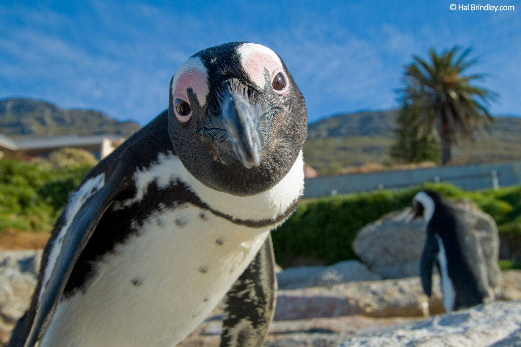
- Boulders beach Penguins: African Penguins are also known as Jackass Penguins, Spheniscus demersus (Latin) and Blackfoot Penguins.
- Cape Point: The new lighthouse at Cape Point is one of the most powerful on the South African coast. Its lights have a range of 60 kilometres and each flash has an intensity of 10 million candelas.
Mini Map of the Tour Route
Tour Highlights
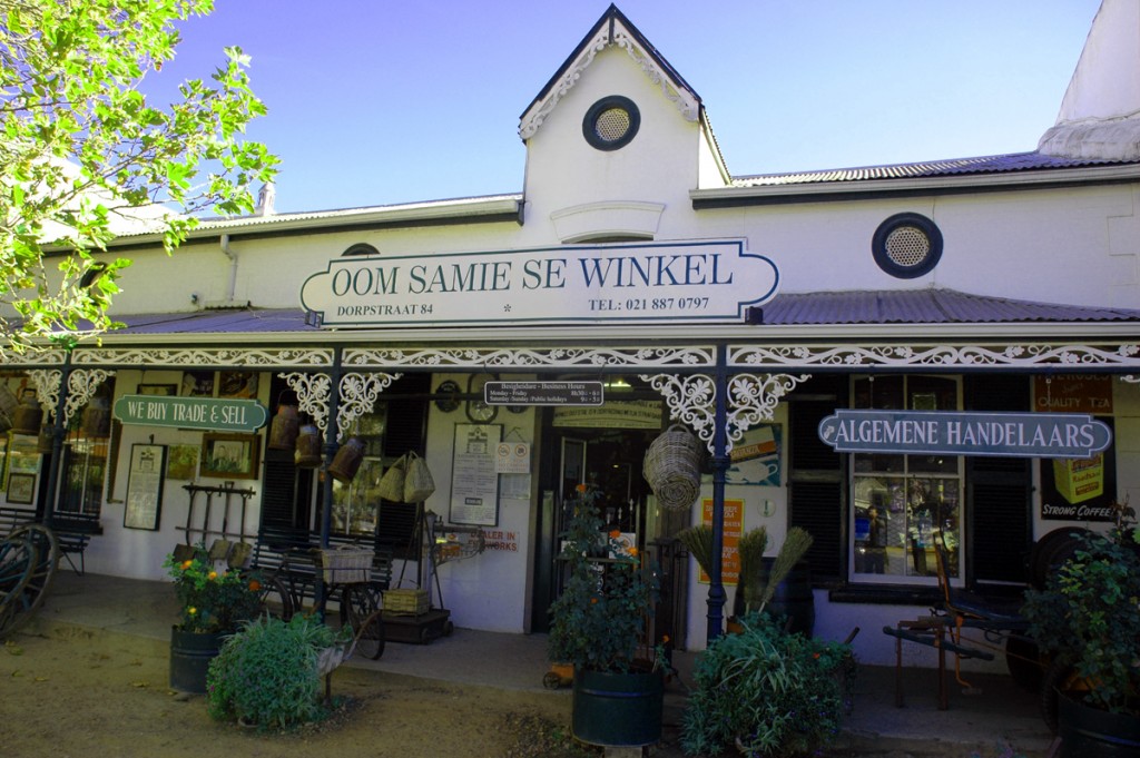
Stellenbosch City Tour
We visit perhaps one of the most interesting Towns in South Africa, its history and culture piqued the interest of both visitors and scholars alike.
In 1679 Simon van der Stel, while on an inspection of the outposts and a search for more arable land in the Hottentots Holland area, came across the Eerste Rivier (“First River”- named by Corporal Willem Muller simply because it was the first river he crossed on an expedition in 1655) and set up camp on an island formed by the double course of the river. He named the area Simon van der Stel se Bos (Simon van der Stel’s bush) and knew this beautiful valley called for settlement, it was suitable for agriculture and watered by the Eerste Rivier, later it became known as Stellenbosch (Stel’s Bush).
In 1683 some farmers settled around the Stellenbosch area. The town however, was only established in 1685 when Commissioner Baron Hendrik Adriaan van Rheede accompanied Simon van der Stel on a visit to the area and stipulated that a Drostdy be erected on the island and a town be laid out. Van Rheede was managing the affairs of the VOC (De Verenigde Oostindische Compagnie – the Dutch East India Company) in the Cape. Jan Mulder was appointed as the first landdrost (magistrate) and the town was laid out. By now farms were being cultivated and the first vines were planted in Stellenbosch, some of the farms’ names have survived to this day, which include: Mostertsdrift, Jonkershoek, Idas Vallei, Coetzenburg and Koelenhof.

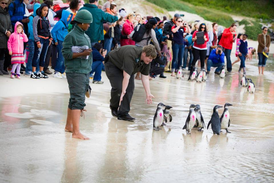
Simons Town & The Penguins at Boulders Beach
The Boulders Beach penguins are about as famous as birds can be. They’re also ever-more endangered. The birds, who draw crowds of visitors who can’t resist their waddling ways, are under threat from loss of habitat, dwindling fish resources, and their human neighbours.Each year, around 60 000 visitors flock to Simonstown to photograph and watch the the famous Boulders Beach penguins. Few visitors though, realise that for all their amusing antics and endearing appearance, African penguins are increasingly endangered.
Boulders Beach remains the only place in the world where one can get up-close to African penguins. Penguin viewing is made easier by boardwalks that traverse the beaches and an information centre, which is managed by South African National Parks (SANParks).
Years of over-fishing, pollution, egg predation by seabirds, and guano scraping of their preferred nesting sites has left Africa’s penguins in peril, but there’s hope.
In a bid to curb the continued loss of chicks, and provide a safe breeding environment, Boulders Coastal Park management has introduced artificial nesting boxes. And, thanks to conservation initiatives by the Southern African Foundation for the Conservation of Coastal Birds (SANCCOB), the Dyer Island Conservation Trust, and SANParks, Simonstown’s precious penguins may yet survive to swim another day.
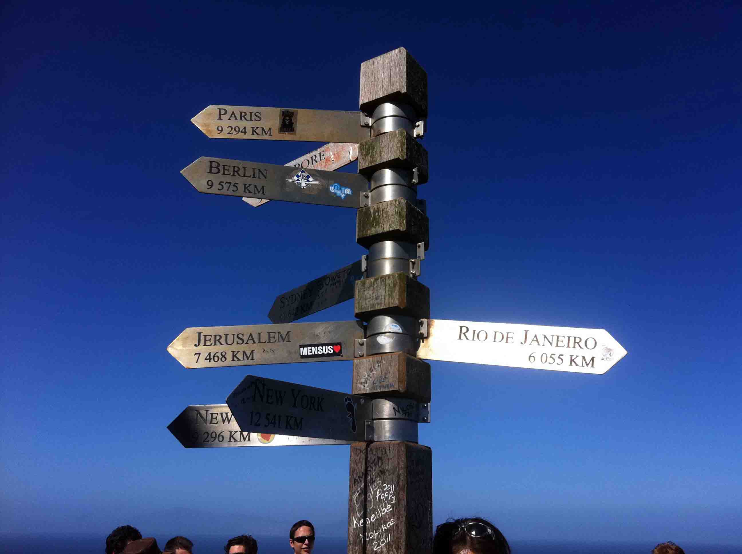
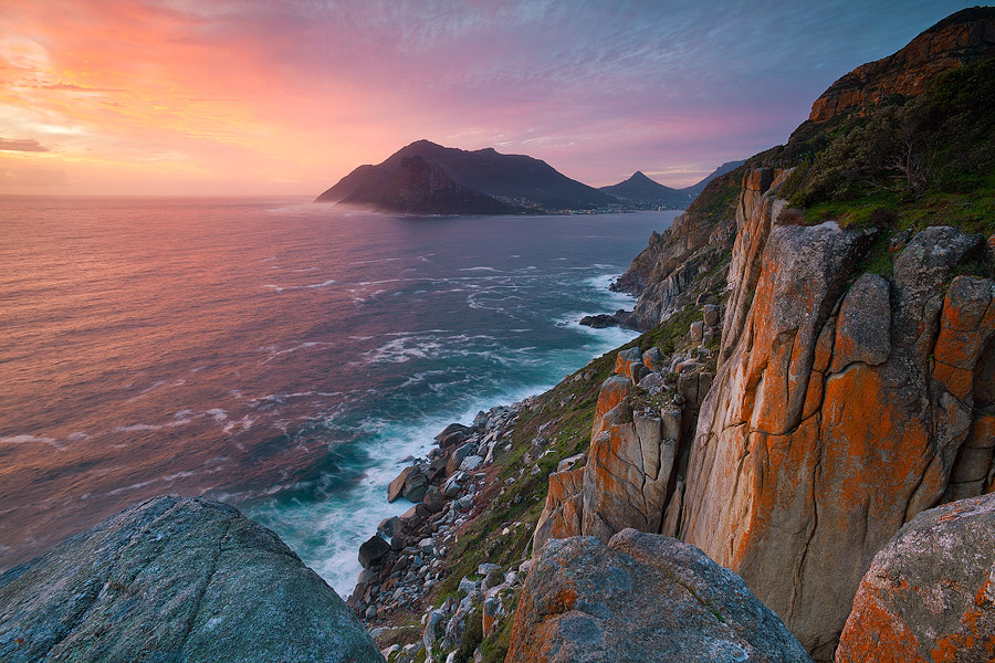
Cape Point Nature Reserve & Cape Of Good Hope
Bartholomeu Dias, the Portuguese seafarer, was the first to sail around the Cape (in 1488). On his return voyage, which must have been particularly stormy, Dias stopped at the south-western tip of South Africa, and named it Cabo Tormentoso, or Cape of Storms. King John of Portugal later gave it the name Cabo da Boa Esperança, or Cape of Good Hope. Another Portuguese explorer, Vasco da Gama, rounded the Cape on 22 November 1497 on his way to India.The journeys of these explorers led to the establishment of the Cape sea route. This meant more regular sailings around the tip. It also indirectly to led to a number of casualties along these unpredictable shores. Today, shipwrecks and stone crosses bear testimony to the treacherous and challenging historic sea route.
The lighthouse at Cape Point is the most powerful on the South African coast. It has a range of 63 kilometres, and beams out a group of three flashes of 10 million candlepower each, every 30 seconds. But, through history, mariners had taken a rather dimmer view of warning beacons around the Point.
A lighthouse was built In 1857, on Cape Point Peak, 238 metres above sea level. The equipment for the lighthouse had been shipped from England. However, because of its high position, clouds and fog often obscured the lighthouse. In fact, for an alarming 900 hours per year on average, its light was invisible to ships at sea at a certain angle.After the Portuguese liner Lusitania ran aground on 18 April 1911, the lighthouse was moved to its present location above Cape Point, only 87 metres above sea-level. A stone replica of Vasco Da Gama’s cross which was planted there in 1487 stands tall on the hillside above the beach. It marks the spot where the Portuguese explorers had come ashore.

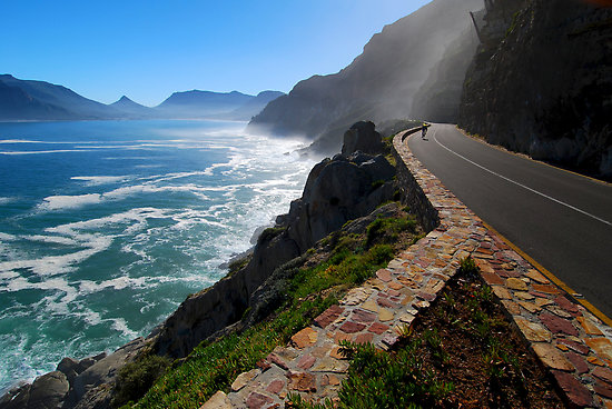
The Atlantic Seaboard & Chapman’s Peak
Chapman’s Peak is about 15 kilometres south of Cape Town, South Africa. It is opposite the inlet on which the town of Hout Bay is centred., The western flank of the mountain falls sharply for hundreds of metres into the Atlantic Ocean. A spectacular road, known as Chapman’s Peak Drive, hugs the near-vertical face of the mountain from Hout Bay to Noordhoek.
Hacked out of the face of the mountain between 1915 and 1922, the road was at the time regarded as a major feat of engineering. Chapman’s Peak Drive was closed in the 1990s, after a rockfall caused a death and a subsequent lawsuit, and subsequently reopened after being re-engineered to protect motorists from falling rocks. It was reopened in 2005 as a toll road. The road was again closed for a number of months beginning on 19 June 2008 “as a result of risk areas identified on the mountain above the road”, but has since been reopened indefinitely
Chapman’s Peak is named after John Chapman, the pilot of an English ship becalmed in today’s Hout Bay in 1607. The skipper sent his pilot ashore to find provisions, and the name was recorded was Chapman’s Chaunce.
Fishing Village of Hout Bay
Hout Bay is often called the Heart of the Cape, a 20 minute drive from the Cape Town city centre, almost halfway between Cape Town and Cape Point. Houtbaai, named by Dutch explorers, literally translated means Wood Bay.Jan van Riebeeck described Hout Bay as having the most beautiful forests he had ever seen. The timber was used to help build the fort at Cape Town and the subsequent port that grew to Cape Town city.Hout Bay was then divided up into a few farms Kronendal, Moddergat and Ruyteplaats. Over time the farms were divided up however today Hout Bay still enjoys a rural atmosphere with several equestrian estates and small holdings.
Hout Bay has become very popular as a seaside resort town with its unique location at the start of the Atlantic Seaboard and yet still only thirty minutes drive from most of Cape Towns top attractions. Hout Bay is recognised as one of South Africa’s leading destinations for local tourists and has become a popular place for international tourists to base their South African holiday. A growing bed and breakfast industry supports the demand from holidaymakers. Hout Bay real estate now includes holiday accommodation, family homes ranging from apartments to seaview properties in security estates.

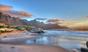
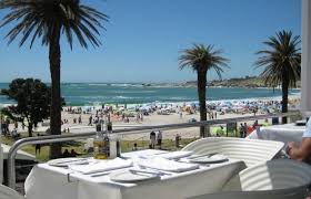
Camps Bay
Palm-fringed, with platinum blonde sands (and bathers to match), Camps Bay beach is where the well-to-do and the famous congregate to see, and be seen. This Cape Town beach is all about being gorgeous, from its manicured shoreline overlooked by millionaire’s mansions, to dazzling sunsets and minimalist swimwear.Located between Bakoven and fashionable Clifton, Camps Bay Beach is the Blue Flag beauty among a string of trendy Atlantic seaboard beaches along this scenic stretch of coastline.
Named after sailor, Frederick von Kamptz, Camps Bay was originally a farm set against the ‘the twelve great buttresses of the back of Table Mountain’, better known as the Twelve Apostles.Today, the slopes overlooking this Cape Town beach are littered with expensive multi-story penthouses and designer apartments, only accessible via ultra-skinny roads, and all vying for the best sea views
Social Share
Last Minute deals